Overview
Land decisions fail on two things: boundaries that don’t match the record, and drawings that don’t match the ground. BCBD’s surveyors resolve both — in the field and in the office — producing plans, sections, profiles and volumes in-house, in the scale and format your project requires, in 2D and 3D.
Boundary surveys
A boundary survey establishes the perimeter of a property as it relates to the legal description of the site — the foundation of any pre-construction due diligence. BCBD surveyors review the recorded documents, inspect the site physically, and superimpose the digitised Mouza map on the site layout to determine the plot-wise distribution within the boundary.
Where the survey reveals encroachments on or over the boundary, we don’t just report the problem — we can assist in resolving it, through an easement or a boundary-line agreement, and file the record of survey with the relevant agencies as required.
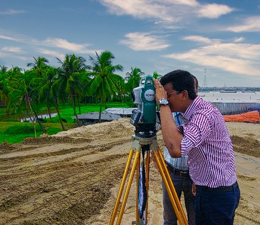
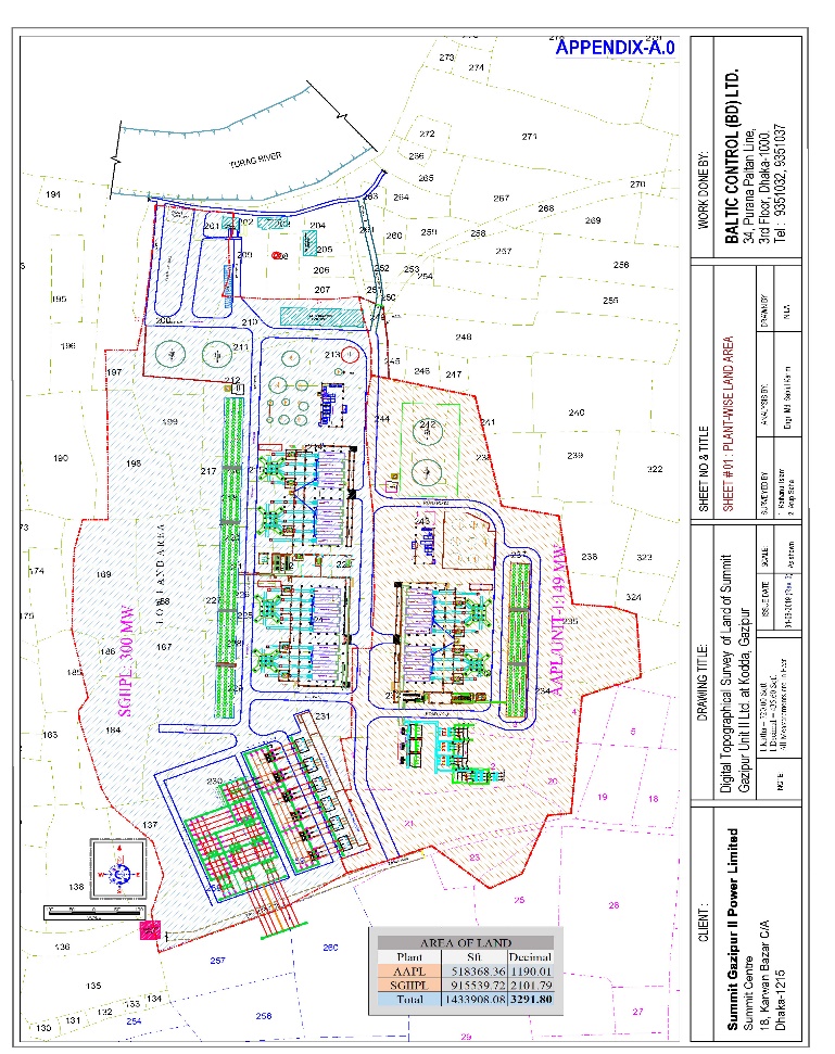
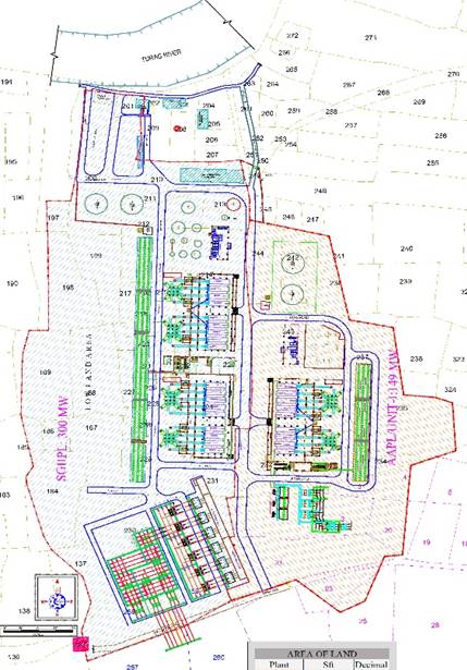
Topographical surveys
Topographical surveys produce true-to-scale maps and plans of the natural and built environment — from floor, ceiling and window levels for a single building to full site topography for engineering works. Architects and engineers use them to define the ground truth of a site before it is developed or changed; they also serve as condition records for conservation, quality control and certification at each stage of a project.
Though we call ourselves land surveyors, the work extends to the sea bed and underground, with data gathered by remote sensing from the air and from satellites where the project calls for it. Outputs — 2D and 3D plan drawings, sections, profiles and volumes — are produced entirely in-house.
Construction staking & site layout surveys
Construction staking translates the engineering design into marks on the ground — the reference points that guide where roads, buildings and structures are actually built. Done properly, it is what keeps a project on schedule, on budget and true to the approved plans.
Engineering design surveys
Constructible projects begin with an engineering design survey, requested by the civil engineer in charge of the design. Our surveyor works alongside the engineer to capture the existing conditions in and around the proposed project and establish the controlling elements on which the design will rest, including:
- Condition of the adjacent streets and access from adjoining roads
- Location of visible improvements and easements
- Field measurement of elevations — topography, cross sections, contours, profiles
- Evidence of electrical / gas / sewer / water utilities servicing the site
- Improvements and conditions around the perimeter of the site
- Evidence of underground contamination, dumping or access from adjacent property
- Whether the site is buildable
These surveys draw on land, hydrographic and geophysical methods as the project demands — for roads and bridges, drainage basin studies, stormwater and water-quality improvements, and sewer retrofit projects.
As-built surveys
An as-built (or physical) survey shows the property as it actually stands at a point in time. During a project it verifies each stage against the design; at close-out it is the document that confirms the authorised work was completed to plan and in compliance with the relevant standards and regulations — built on the project base map, updated with current ground-level topography and visible improvements.